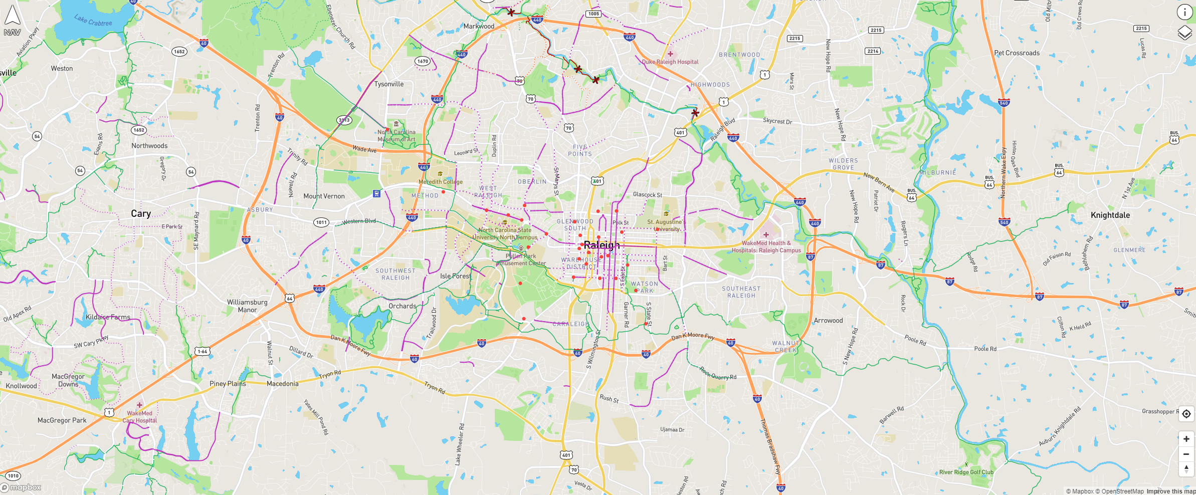
Did you know that Oaks and Spokes has a bike map at map.oaksandspokes.com that helps you get around Raleigh and the Triangle? It works on both smart phones and computers, and provides information about greenways, bike lanes, Raleigh Citrix Cycles, and recommended routes. It also provides route recommendations, allows the user to change the map background.
We sat down with one of the creators to chat about the map if you would like to learn more:
Can you briefly describe The Triangle Bikeways Map?
Sure. It’s a map of the Triangle area that shows all the existing bike infrastructure and route recommendations.
What made you decide to make a new bike map for Raleigh?
It had been hard to put together all the different sources of bike infrastructure data and recommended routes. Before we made this map, if you wanted to bike from Raleigh to Cary you’d have to first look at the bike map from Raleigh, which you’d download from the Raleigh website, and then it would cut out at the city border, you’d go onto the Cary website and download their pdf with all of their routes and planned future routes in one page, look at that on your smartphone, it was difficult to sort out all that information. I thought bringing it together in one place would be extremely useful.
Definitely. I’ve also gotten some dangerous route recommendations from Google maps, and I’ve found that the printed maps from the city are sometimes out of date, and the street names are unlabeled, or the type of street is unclear. Having a clear, beautiful map to facilitate conversations about routes is really useful.
Will you talk a bit about how the map is made and where the dataset comes from?
The map is a webpage right now, built in Javascript. I got the information from a lot of different sources. Most cities have published open GIS datasets that we can pull down. They say what infrastructure is currently out there, what their recommended routes are, or – if there isn’t any bike infrastructure – which calm roads can take you where you’re going. We also use OpenStreetMap, which is like a Wikipedia for maps, anybody can go on and update the map. We’re using OpenStreetMap as the source of all the bike infrastructure, but then using the city data to double check it.
How does the map stay up to date?
There’s a weekly sync that pulls OpenStreetMap data and populates it into our map.
What challenges have you faced in making this map?
The biggest challenge is making it usable on mobile phones. I want people to go to the webpage and know how to use it without having to be taught, either on a mobile phone or on a desktop. That’s very difficult.
How does the route recommendation work?
The mapping library provider also has a routing service. Implementing routing looks extremely difficult, and reinventing that would be a lot of effort, not the best use of our time. It’s a classic computer science question right there. But there’s not enough data to provide better routing info than we have now.
How do I find the map?
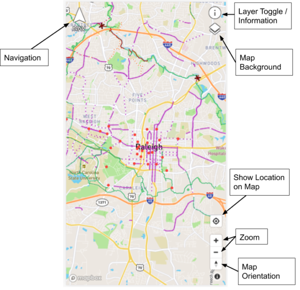
Go to map.oaksandspokes.com. If you’re on a mobile phone, it will pop up a little ‘add to homescreen’ button, and you can click that. It’ll create a shortcut to the webpage that acts like a true application – it’ll create a little icon on your home screen.
Also, some people don’t realize there’s routing. The little arrow in the top left corner will open up directions.
How can folks contribute to the map?
Keeping OpenStreetMaps data updated is really helpful. If you have a programming background and you want to help, you can reach out to map@oaksandspokes.com. Most importantly, you can provide feedback. There’s a way to send feedback from the app, or email map@oaksandspokes.com and give us your ideas about how it can be improved, if we’re missing something, if you didn’t understand something, if you find a bug. That would be greatly appreciated.